

Last week’s winter storm hit millions of Americans hard and inflicted significant damage on one of the country’s most iconic thru-hikes. Georgia’s recent winter storm left fallen trees and hazardous conditions on over 70 miles of the Appalachian Trail (AT). Here’s what you need to know.
The Impact
The AT crosses many states that were hit by the storm. However, reports from the U.S. Forest Service and Appalachian Trail Conservancy (ATC) indicate that Georgia’s portion of the AT fared the worst.
According to the ATC, as of Jan. 29, forest roads that provide trail access at Tesnatee Gap and Hogpen Gap are impassable. The road to Springer Mountain Trailhead, the trail’s southern terminus, “is in very rough shape following the storm.”
The organization also said that the storm “left downed trees, unstable footing, and other hazardous conditions along portions of the AT from Springer Mountain to the Georgia state line (NOBO miles 0 to 78.3).”
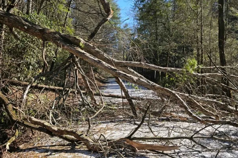
The USFS provided further details on the conditions on these 78 miles, which all fall within the Chattahoochee–Oconee National Forest. Ongoing issues include “falling trees and downed limbs, possible power outages and blocked access routes, and limited or delayed emergency response due to conditions.”
The USFS “strongly encouraged” hikers to postpone their trips through these areas. The Southeast has seen extremely cold temperatures this week (below 0 degrees), which the ATC said might hamper or slow recovery work.
There is no clear timeline for when these issues might be resolved. Further storms are expected to hit Georgia this weekend.
For updates, visit the ATC’s website here.
Read the full article here